USDA Plant Hardiness Zone Map Guide for Maryland Gardeners
Maryland gardeners may see different hardiness zones listed for nearby towns, and even a correct zone can be a poor guide to when vegetables are safe to plant. The USDA map is useful for choosing plants that can withstand typical winter cold, but it does not predict every yard’s conditions. Here’s how to read it, account for Maryland’s varied landscapes, and use it alongside other planning tools.
What the USDA Plant Hardiness Zone Map measures
The USDA Plant Hardiness Zone Map is a guide to how cold a place typically gets in winter. Its zones are based on the average annual extreme minimum winter temperature: in other words, the average of the coldest temperature recorded in each year over a long period. The map groups that information into broad zones, with narrower subdivisions within them.
That measure helps estimate whether a perennial plant, shrub, or tree is likely to survive typical winter lows at a location. It is a guide to winter survival, not a prediction of the coldest temperature that could ever occur there. A colder-than-usual winter can still damage a plant that generally suits the mapped zone.
A zone also does not describe the full climate of a garden. It does not tell you how hot summer gets, how long the growing season lasts, how much rain falls, or whether the soil stays wet. Nor does it indicate how often spring frost occurs or when a particular year’s last frost will arrive.
That narrow purpose is useful. If you are comparing perennial plants, the map can help you screen out choices that are unlikely to tolerate your area’s typical winter lows. But a plant’s hardiness rating is only one part of choosing the right plant. Drainage, sunlight, wind exposure, summer heat, and moisture can all matter just as much to whether it thrives.
| The map can help you assess | The map does not tell you |
|---|---|
| Whether a perennial, shrub, or tree is broadly suited to typical winter lows | The date of the last spring frost |
| How winter cold varies across larger areas | The coldest temperature a site could ever experience |
| Whether a plant’s listed cold tolerance is a reasonable starting point | Whether a plant will tolerate wet soil, drought, wind, or summer heat |
| Why nearby locations may have different winter conditions | The best date to sow vegetables or set out tender transplants |
| Which plants may need extra attention in an exposed site | Whether one particular plant will thrive in a particular yard |
For the details behind the map’s winter-survival measure, see What a Plant Hardiness Zone Tells You About Winter Survival. That distinction is central to using the map well: it is a tool for evaluating typical winter cold, not a calendar for every gardening decision.
How to read a zone for a Maryland location
Start with the location where the plant will grow, not just the name of the nearest city. A map lookup provides a useful regional reference, but a broad geographic label can hide meaningful differences in elevation, exposure, and landscape. A yard on a slope, beside a building, or in a low hollow may not behave like the general area shown by a map.
A ZIP-code lookup can be a convenient first step, especially when comparing plants or narrowing a search. It should not be treated as a measurement of the exact conditions at your garden. ZIP codes cover areas rather than individual planting sites, and local terrain can create small differences the map cannot show. For a closer look at the limits of that shortcut, see How to Look Up Local Hardiness Zones by ZIP Code.
When checking a map or plant label, pay attention to the zone information for the plant itself. A listing may describe a plant as hardy in a range of zones, or may give a minimum cold-tolerance rating. That rating tells you about the plant’s ability to survive winter cold under suitable conditions. It does not guarantee survival in every garden within that range.
Consider what “survive” means in the context of your goal. A perennial may live through winter but suffer damage to its top growth. A shrub may survive but flower less after a harsh season. A fruit tree may stay alive while its blossoms are damaged by a late freeze, reducing that season’s crop. The map cannot promise a specific level of performance.
It is also worth checking whether a plant is being described as reliably hardy or merely capable of surviving in a favorable site. A sheltered spot with good drainage may help a borderline plant, while an exposed or waterlogged location may make even a well-matched plant struggle. Look for growing requirements beyond the zone, and compare them with the conditions at the planting site.
Use the following process when a plant label or online listing gives a hardiness rating:
- Look up the location as a starting point. Use the map to understand typical winter cold in the broader area.
- Check the plant’s stated cold tolerance. Confirm whether the location fits the plant’s listed requirements.
- Compare the site with the plant’s other needs. Note sun, soil moisture, drainage, and exposure.
- Consider local variation. Ask whether the planting spot is colder, windier, wetter, or more sheltered than its surroundings.
- Use another source for timing. For sowing, transplanting, and frost risk, consult a local planting calendar rather than relying on the zone.
This is especially useful when shopping for landscape plants. A label that matches the mapped zone can help identify promising choices, but it is not a guarantee. A plant may fail because of poor drainage, an unsuitable amount of sun, pests, disease, or stresses that have little to do with winter minimum temperature.
Why Maryland’s regional variation matters
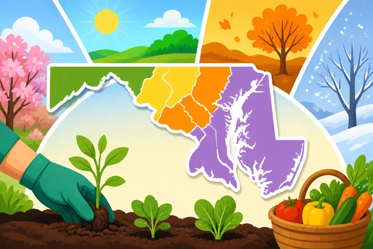
Maryland has several broad landscape regions, including the western highlands, the Piedmont, and the Coastal Plain. Winter cold, elevation, proximity to the coast, and local terrain vary across the state. That variety is one reason a state-wide generalization can be misleading: a map is more useful when you check the location and then think about the specific site.
The western part of Maryland includes higher and more varied terrain. Elevation and exposure can influence winter conditions over relatively short distances. A location on an exposed slope may experience different conditions from a protected site nearby, while a low spot can collect cold air. A map helps describe the larger pattern, but a garden’s position in the landscape adds another layer.
The Piedmont includes a mix of hills, valleys, developed areas, and open sites. A property in a sheltered neighborhood may have different conditions from a nearby exposed field or low-lying garden. Buildings, paved surfaces, tree cover, and slope can all affect how a site warms, cools, or holds moisture.
The Coastal Plain and Eastern Shore have their own patterns shaped by lower elevations, coastal influence, and local exposure. Proximity to water may moderate some temperature swings, but it does not make every site equally mild. Wind, open exposure, and the shape of the land still matter. A coastal location can also face stresses such as salt exposure or sandy soil that the hardiness map does not measure.
Within any of these regions, your yard may have several small climates. The south-facing side of a building can warm earlier than an open northern exposure. A sheltered courtyard may avoid some wind, while a frost pocket at the bottom of a slope can stay colder on clear nights. A sunny bed beside a wall may be warmer during the day but still experience a damaging cold snap.
For this reason, do not assume that a nearby town, county label, or broad regional description perfectly represents every planting area on your property. Use the map to identify the larger winter pattern, then observe your yard. If you keep garden notes, record where frost lingers, which beds warm first, and where winter damage is most common. Those observations can improve plant choices over time.
For a closer look at how schedules shift by area, see Maryland Planting Dates: Shifting Schedules by Region and County. The map’s regional context can help explain why two gardeners may get different results from the same planting advice, but local timing still needs its own assessment.
Using the map to choose perennials, shrubs, and trees
The map is most useful when you are choosing plants expected to live outdoors from year to year. That includes many perennials, shrubs, and trees. For these plants, winter survival is a practical first question: can the plant tolerate the typical cold in the area where it will grow?
Use the rating as a screening step rather than a final decision. If a plant’s listed cold tolerance appears suited to the mapped location, move on to its other requirements. Check how much light it needs, whether it prefers dry or moist soil, and whether it can handle the site’s exposure. A plant that fits the winter-cold measure but dislikes the soil or light is still a poor match.
Drainage deserves particular attention. Some plants tolerate cold well but are vulnerable to winter damage in consistently wet soil. In those cases, improving the site or choosing a plant suited to its moisture conditions may matter more than the map result. Likewise, a plant that likes cool, moist conditions may struggle in a hot, dry, south-facing bed even if winter survival is not a concern.
Consider wind and winter exposure, too. An exposed site may dry out evergreen foliage or intensify cold stress. Plants beside a wall or under a canopy may be protected from some wind, but they may also receive less light or compete with tree roots for moisture. The map cannot capture all of these effects, so compare the plant’s needs with the actual planting location.
For plants near the edge of their listed hardiness, weigh the risk carefully. A plant may survive most winters but be damaged during unusually cold conditions. If it is a favorite you are willing to protect or replace, that may be an acceptable trade-off. If you want a low-maintenance planting that should perform reliably, selecting plants comfortably suited to the site is usually the more conservative choice.
A useful comparison is to think in terms of confidence and maintenance:
| Plant choice | Potential benefit | Main trade-off |
|---|---|---|
| A plant comfortably suited to typical local winter cold | A stronger starting point for reliable survival | It may not be your first choice for appearance or function |
| A plant near the limit of its stated cold tolerance | More options for a particular look or use | Winter damage or loss may be more likely |
| A plant suited to a sheltered microclimate | May perform well in a protected part of the yard | Conditions can vary within the property, and the shelter may be incomplete |
| A plant selected only by its zone listing | Quick initial screening | May fail if light, soil, drainage, or moisture is wrong |
Maryland gardeners choosing longer-lived plants may also find How Extreme Winter Minimums Determine Maryland Perennial Hardiness helpful. For the planting season itself, see When to Plant Perennials and Shrubs in Maryland for Strong Roots. The hardiness map helps answer whether a plant is a reasonable winter candidate; seasonal timing is a separate question.
Native plants need the same site-based consideration. A plant’s native status does not mean it will automatically grow well in every Maryland yard. Light, soil moisture, and drainage still need to match its requirements. For help matching plants with those conditions, see Matching Native Maryland Species to Sun Exposure and Soil Moisture.
What the map cannot tell you about planting dates
A common mistake is to use a hardiness zone as if it predicted the last spring frost. It does not. The map summarizes typical winter cold; it does not indicate when frost will stop occurring in spring, how early warm weather will arrive, or whether a sudden cold snap will damage new growth.
That matters most when planting vegetables and other frost-sensitive plants. A location may have a favorable hardiness rating for a perennial and still experience spring frost that can damage tender seedlings. Conversely, a hardy vegetable may grow in cool conditions even when it is not time to plant heat-loving crops. Planting decisions depend on the crop, frost risk, soil temperature, and local weather—not just the zone.
For local planning, use frost information and planting windows that account for Maryland’s regional differences. Does Your USDA Hardiness Zone Predict Your Last Spring Frost? explains why the two measures are not interchangeable. Frost Dates and Planting Windows Across Maryland Climates is a better starting point when you need to plan around frost probability, while Maryland Planting Calendar: What to Sow and Harvest Now can help organize seasonal tasks.
Even a frost-date estimate is not a guarantee. Frost dates are probabilities based on historical observations, and actual weather varies from year to year. A forecast can also change quickly. Gardeners should use local forecast information and be ready to protect vulnerable plants when conditions call for it.
The map also does not tell you when the soil is warm enough for a crop. Some seeds germinate poorly in cold soil, while other crops tolerate cool conditions. A warm-season crop may need settled warmth even after the risk of frost has eased. Use crop-specific information for sowing and transplanting, and pay attention to soil conditions rather than treating one date as a universal cutoff.
A few other questions are outside the map’s scope:
- How long is the growing season? The zone does not provide a reliable count of frost-free days for your garden.
- Will a fruit tree’s blossoms escape frost? Winter survival of the tree and spring survival of its flowers are different issues.
- Will a plant tolerate a hot summer? The map focuses on winter lows, not heat tolerance.
- Will a plant survive a wet winter? It does not measure drainage or soil saturation.
- Can a plant handle a windy site? Wind exposure is not represented by the zone.
- When should seeds be sown? Use the crop’s needs, local planting windows, and current conditions.
For vegetable sowing, the map is not a substitute for crop-specific calendars. Why Hardiness Zones Do Not Tell You When to Plant Spring Crops explores that distinction. A zone lookup may help you understand your general winter climate, but it should not be used alone to time vegetables, annual flowers, or any plant that is sensitive to spring frost.
A practical way to combine the map with your yard
A reliable planting decision combines three kinds of information: the broad winter pattern shown by the map, the conditions at the planting site, and the requirements of the plant. This approach avoids treating one map label as a complete description of a garden.
Begin by identifying the part of the yard where the plant will actually grow. Note whether it is open or sheltered, level or sloped, exposed to wind, or close to a wall, pavement, or dense canopy. Consider whether water drains away or collects there. If the site has a history of frost damage or winter dieback, record that too.
Next, look up the mapped location. Treat the result as a regional reference rather than a promise about one bed. If the lookup offers a choice between a general area and a more detailed location, use the more relevant information available, but remember that a digital result cannot account for every yard-level feature.
Then read beyond the plant’s hardiness rating. Check light requirements, moisture preferences, soil conditions, mature size, and susceptibility to local stresses. If the plant is edible, consider whether your growing season is long enough for it to mature. If it is a flowering perennial or fruit tree, distinguish winter survival from reliable flowering or fruiting.
Finally, decide how much uncertainty you are willing to accept. Gardeners who prefer dependable, low-maintenance plantings may want to favor plants well matched to the site. Gardeners willing to experiment can try a plant near the edge of its stated tolerance in a protected spot, while accepting that a harsh winter may cause damage. Neither choice is automatically right; the trade-off is between reliability and flexibility.
A simple checklist can keep the decision focused:
- Is this a plant whose winter survival is the main concern?
- Does its stated cold tolerance appear compatible with the mapped location?
- Is the planting site more exposed, wet, windy, or cold than nearby areas?
- Do the sunlight and soil-moisture conditions match the plant’s needs?
- Is the plant sensitive to spring frost, summer heat, or winter wetness?
- Would occasional protection or replacement be acceptable?
- Is a separate planting calendar needed to determine timing?
For spring vegetables and annuals, follow a planting guide designed around frost and crop requirements. For long-lived landscape plants, give more weight to winter hardiness and site conditions. For fruit crops, consider both the tree’s ability to survive winter and the vulnerability of flowers to spring cold. Each use calls for a different mix of information.
Garden records can make the map more useful over time. Note the location of plants that suffered winter damage, the date you noticed new growth, and whether a cold spell or wet soil may have contributed. Track which areas thaw or warm first, where frost lingers, and whether wind protection seems to help. These observations do not replace regional climate information, but they help you make better decisions for your own property.
If a plant performs poorly, do not assume the hardiness rating was the only issue. Check for signs of waterlogged soil, drought stress, unsuitable light, pests, disease, or damage from animals. A plant can be hardy enough to survive winter and still struggle for another reason. A careful diagnosis is more useful than simply choosing a different zone-rated plant.
Frequently Asked Questions
Does the USDA Plant Hardiness Zone Map tell me when to plant vegetables?
No. It describes typical winter cold and helps assess whether many perennial plants are likely to survive winter. Vegetable planting dates depend on the crop, frost risk, soil conditions, and local weather. Use a Maryland planting calendar or crop-specific guidance for timing.
Can two gardens in the same area have different conditions?
Yes. Slope, elevation, wind exposure, nearby buildings, pavement, tree cover, and drainage can create different conditions within a neighborhood. A map gives a regional reference, while your yard’s features affect the planting site.
Does a matching zone guarantee that a plant will thrive?
No. A suitable hardiness rating is a useful starting point, not a guarantee. Light, soil moisture, drainage, heat, pests, and other conditions also affect plant health. A plant may survive winter but still grow or flower poorly.
Should I rely on a ZIP-code lookup for my exact garden?
Use it as a convenient starting point, not an exact measurement. ZIP codes cover larger areas, and local terrain or yard features may affect conditions. If you are choosing a plant with limited cold tolerance, consider the specific site as well as the map result.
Is the map useful for annual flowers and vegetables?
It can provide general climate context, but it is not usually the main tool for timing annual flowers or vegetables. Frost tolerance, soil temperature, and the crop’s growing requirements are more relevant to those decisions. Check local planting guidance before sowing or transplanting.
Disclaimer
This article is for general informational purposes only and does not constitute professional advice. Laws, prices and regulations vary by location and change over time. Consult a qualified professional for guidance on your specific situation. Maryland Gardening Guide is not a government agency and is not affiliated with any university extension, state department of agriculture or other government agency.